...
- Identify the join field in both sets of data
- Run QGIS
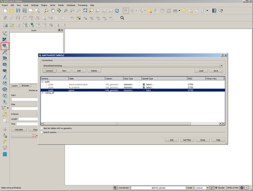
- Load your spatial data. In this example we're using a simple shapefile postgis table containing some address point data. We load the data by selecting the PostGIS icon and identifying the database and the table name. Selecting 'Add' loads the data into QGIS. The identifier in our case is the UPRN.
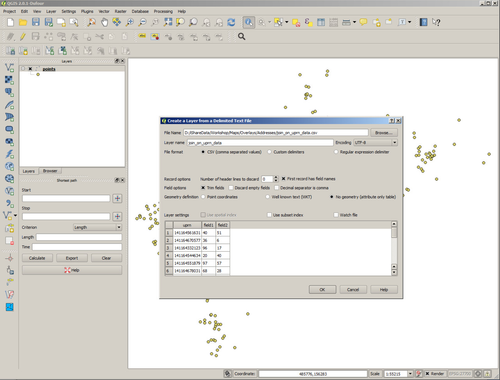
- Load the non-spatial data. In our case the non-spatial data is in a csv file.
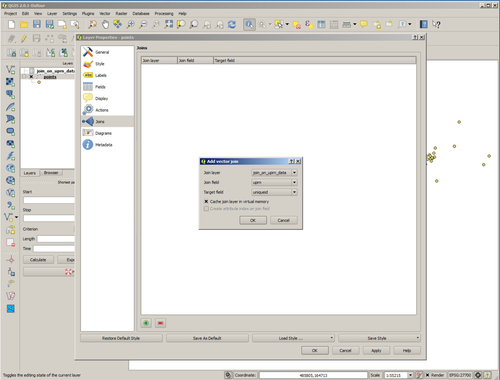
- Open the Properties dialog of your spatial layer and select Joins.
- Create a new Join by selecting the '+' button and identify the non-spatial layer and the fields that are going to form the join.
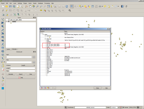
- Now use the identify tool on the layer and you'll see that the additional fields held in the non-spatial layer are now displayed.
- Make a cup of tea.
...