Overview
Astun Data Services provide a range of geographic data as web services for consumption as Base mapping within web mapping and desktop GIS applications.
The use of Astun Data Services provides a cost-effective and resource-free alternative to translating, storing, updating and serving base mapping data to internal and public users.
Astun Technology are happy to extend ADS to include custom Aerial Photography or Raster maps; which we have done for several customers already.
BaseMap Data Services
Managing Ordnance Survey base map data and imagery requires specialist software and can be time consuming. Astun Data Services offers a simple low cost alternative for PSMA members (or those with an alternative OS licence) to access national cover (or a licenced subset) of MasterMap and other data sets, including OS OpenData as WMS, WFS or WMTS and a vector download service with a number of attractive cartographic styles.
BaseMap Data Services include national coverage of the following datasets. Map data is available in British National Grid (BNG) as an Open Geospatial Consortium Web Map Service (OGC WMS) or a Tiled Map Service (TMS) with 15 levels of zoom.
ADS BaseMaps are updated quarterly.
If you wish to configure any of these ADS BaseMaps then please see the topic Configure ADS Base Mapping for iShare.
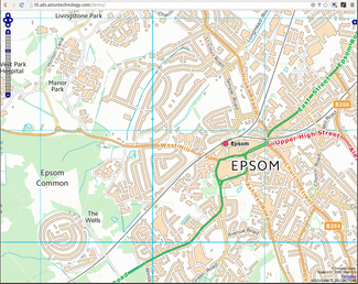
Ordnance Survey Premium Data
- Based on MasterMap, VectorMap Local, Meridian and Strategi
- PSMA or other Ordnance Survey license required
- Available as contemporary Web Cartography or in a Black & White style
- Available in Web Mercator which allows Ordnance Survey data to be used on a map which uses OSM / Google Maps tiles
- Optionally watermarked with organisational logo when required
Service can be restricted to a licensed area defined by a polygon
- OS MasterMap (OSMM) Topography allows you to display at smaller scales than in the usual OS Premium
- There is a Metadata record for OS Premium Vector which tells you the latest update date - select Display Mode Full View and the Identification tab.
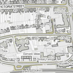
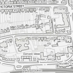
OS Premium Vector | OS Premium Vector Grey |
|---|---|
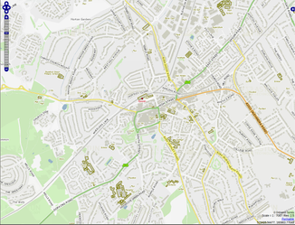 | 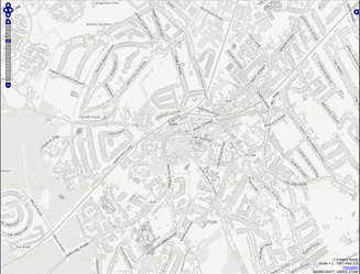 |
OS Premium Raster | OS Premium Raster Grey |
|---|---|
 |  |
OS Premium MasterMap Topography | OS Premium MasterMap Topography Grey |
|---|---|
 |  |
Ordnance Survey OpenData
- Based on VectorMap District, Meridian and Strategi
- Open Government Licence (OGL)
Available as contemporary Web Cartography or in a Black & White style
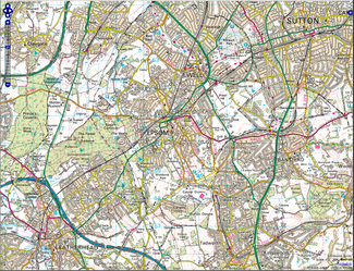
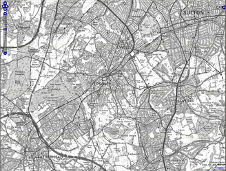
OS Open Vector | OS Open Vector Grey |
|---|---|
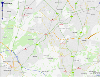 | 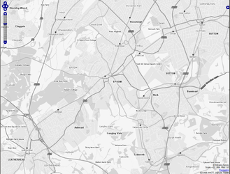 |
OS Open Raster | OS Open Raster Grey |
|---|---|
 |  |
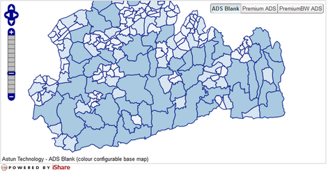
Blank BaseMap
Numerous iShare users have expressed an interest in a ‘blank base map’, particularly for use with iShare GIS and printing. This allows the end user to easily focus on the data and layers displayed via iShare GIS and iShare. A particularly nice feature of this map base is the ability to change the colour of the the ‘blank base’. To change the background colour of the Blank base please refer to Change the ADS Blank BaseMap Colour.
| Blank BaseMap |
|---|
 |
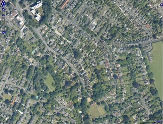
Aerial Photography
| Surrey Aerial 2006 |
|---|
 |
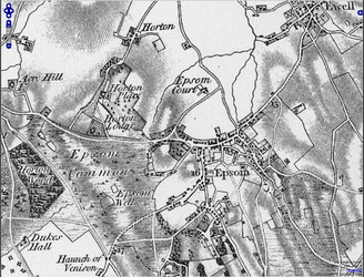
Historic Map Data
ADS hosts two wonderful 'licence free' historical base maps covering the Surrey area, created from source data courtesy of James Rutter at Surrey Heath Borough Council which is now out of copyright.
Colonel Mudge 1819 survey | John Rocque 1767 survey |
|---|---|
 |  |
OS Data Delivery
For iShare in the Cloud (ISiC) Customers the following datasets are typically loaded into either the local iShareData database or the Astun Spatial Data Warehouse (SDW). Please click on the links below to see the Metadata information displaying the latest update dates for each dataset - select Display Mode Full View and the Identification tab.
- Boundary-Line - loaded by default into the iShareData database
- AddressBase Premium - loaded by default into the iShareData database
- OS MasterMap Topography - loaded on request into the SDW
- Code-Point Open - loaded on request into the SDW
Syndicated OpenData Services
Syndicated OpenData Services include national coverage of the following data:
OpenData feeds are syndicated (cached and pre-processed on Astun servers) and served as an Open Geospatial Consortium Web Feature Services (OGC WFS)
NHS Choices
NHS Choices provides public access to health service related information via the web. This includes name, address, postcode, location and URL information for individual services (pharmacies, opticians, hospitals, doctors and dentists). Furthermore the URLs returned from NHS Choices link to a host of additional information, for example, contact information and opening times.
The Astun Data Services (ADS) NHS Choices Downloader essentially acts as a central repository for the NHS Choices data for England. This links seamlessly with the iShare platform allowing NHS service information to be displayed on map layers.
Neighbourhood Crime
The Police UK provide public access to information about neighbourhood areas in all 43 English & Welsh police forces. All forces are required to keep this data accurate and up to date. Astun Data Services [ADS] provide a Police Downloader in the form of a WFS connection for you to download this information.
GIAS / EduBase
There a new service from GOV.UK called Get information about schools (GIAS), which replaces the EduBase service for educational professionals in England. The service supplies a register of educational establishments in England and Wales, maintained by the Department for Education. It provides information on establishments providing compulsory, higher and further education.
The Astun Data Services (ADS) GIAS / EduBase Downloader essentially acts as a central repository for the Educational establishments data for England & Wales and, as the structure of the data has not changed, neither has this service.. This links seamlessly with the iShare platform allowing educational information to be displayed on map layers.
OS Datasets
National coverage of County, District, Ward and Electoral Division boundaries are automatically configured for iShare in the Cloud customers. On-premise customers may ask their Astun Consultant if they require these datasets. Other OS datasets including MasterMap and AddressBase Premium are also available on request.
OS Open Names
OS Open Names is a comprehensive list of Great Britain’s place names, road names and numbers and postcodes combined into one product, increasing search flexibility. It has been designed for multipurpose use – for easy integration into business data warehouses, containing features that enhance the user’s experience in mobile and web mapping applications. The postcodes can be used by creators of route-planning applications as a start or end point.
Astun Data Services (ADS) host the OS Open Names data and supply a Search Web Service which may be used in QGIS or custom applications.
Backup/Restore and Disaster Recovery
Astun Data Services are hosted within the Amazon Elastic Compute Cloud (Amazon EC2) on Amazon Web Services.
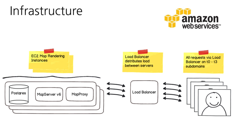
A regular backup copy at each data refresh or software update cycle is replicated to a further instance located within a different geographic region for disaster recovery.