E-forms Integration Example
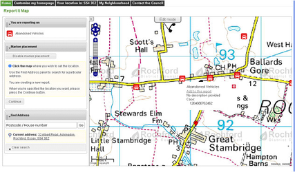
The map is displayed centred detailing all currently reported faults. In this example Abandoned Cars. They can use Zoom and Pan functions to move around the map and hover over an existing point to display the details. They can then choose to add a comment to an existing fault or click on another location on the map to report a new fault.
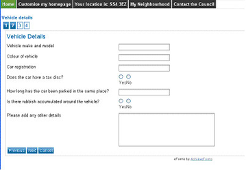
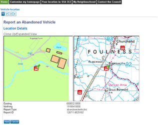
They then click Continue and the easting and northing information is passed to the e-form in this example using Achieve Forms e.g:
Clicking Next takes them to the next step e.g.