Say you have some spatial data and some non-spatial data that you want to join together. Follow the steps below to create the join in QGIS.
Step-by-step guide
- Identify the join field in both sets of data
- Run QGIS
- Load your spatial data. In this example we're using a simple shapefile containing some address point data. The identifier in our case is the UPRN.
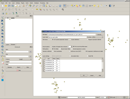
- Load the non-spatial data. In our case the non-spatial data is in a csv file.
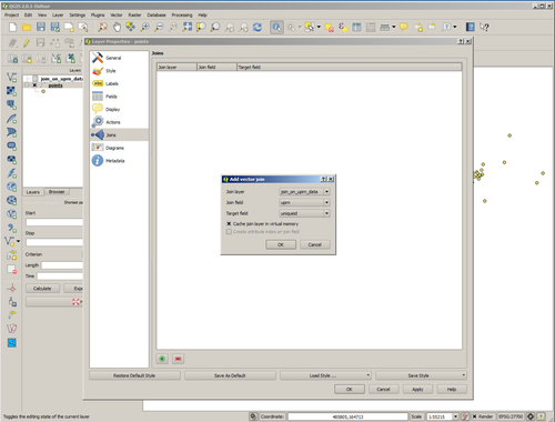
- Open the Properties dialog of your spatial layer and select Joins.
- Create a new Join by selecting the '+' button and identify the non-spatial layer and the fields that are going to form the join.
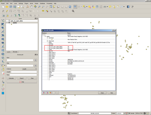
- Now use the identify tool on the layer and you'll see that the additional fields held in the non-spatial layer are now displayed.
- Make a cup of tea.
| Info |
|---|
Related articles
| Filter by label (Content by label) | ||||||||||||||||
|---|---|---|---|---|---|---|---|---|---|---|---|---|---|---|---|---|
|
...