/
Join attribute data in QGIS
Join attribute data in QGIS
By Andrew Bailey
17 Mar, 2016
Say you have some spatial data and some non-spatial data that you want to join together. Follow the steps below to create the join in QGIS.
Step-by-step guide
- Identify the join field in both sets of data
- Run QGIS
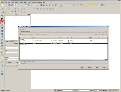
- Load your spatial data. In this example we're using a postgis table containing some address point data. We load the data by selecting the PostGIS icon and identifying the database and the table name. Selecting 'Add' loads the data into QGIS. The identifier in our case is the UPRN.
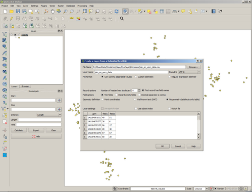
- Load the non-spatial data. In our case the non-spatial data is in a csv file.
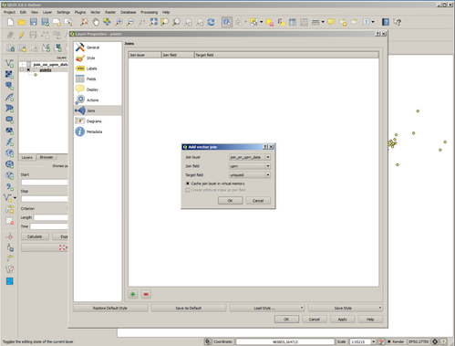
- Open the Properties dialog of your spatial layer and select Joins.
- Create a new Join by selecting the '+' button and identify the non-spatial layer and the fields that are going to form the join.
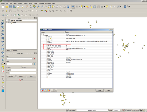
- Now use the identify tool on the layer and you'll see that the additional fields held in the non-spatial layer are now displayed.
- Make a cup of tea.
Related articles
Filter by label
There are no items with the selected labels at this time.
, multiple selections available,
Related content
QGIS-08 3.28: PostGIS Data in QGIS
QGIS-08 3.28: PostGIS Data in QGIS
More like this
Create a Find Nearest Point Layer
Create a Find Nearest Point Layer
More like this
QGIS-07 3.28: QGIS Geo Processing
QGIS-07 3.28: QGIS Geo Processing
More like this
Using iShare Spotlight
Using iShare Spotlight
More like this