The Information Browser is displayed when you perform various searching or selection functions such as Find Nearest or using one of the Select tools and then clicking the Play button or if you click on an object on the map (Info click). Clicking on any underlined value in a field will open a new browser window displaying the linked information e.g. in the following screenshot clicking a link will take you to the page for the selected school.

- Tabs show the different layers that had features within the defined selection area.
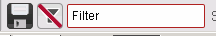
- Show / Hide the Information Browser.
- Popup No matches the number for the entry on the map. Clicking on this number will centre the map on this entry. These numbers are sequential based on the proximity of the results to your chosen address.
- Sort sequence for the results. If you click on the arrow beside the field name it will sort the results either ascending or descending by the value in the field selected.
- Save & Save All buttons allow you to save / export the currently selected tab, or all tabs respectively, to a Comma Separated Values (CSV) text file or a Microsoft Excel file in XML format.
- Create a Spatial Filter for the Layer with the results.
- Filter allows you to filter the selected records, in the current tab, using a string in ANY FIELD. Simply type in the box and the list will dynamically change as you type.
- Pagination of records within the tabs. Click on an entry to display that page of results.
Creating a Spatial Filter
| Info |
|---|
If the Layer is an OGC Layer then a "Filter the layer with these results" button will also be displayed. Click on the button and this will automatically create a Spatial Filter for the layer e.g.
Click on the Show detail link to display the spatial filter e.g.
Once you have created a Spatial Filter you will see a Remove button e.g.
Prior to V5.6.2 clicking the Remove button would remove All filters from All Layers not just the Spatial Filter. |


Find a result on the map
To show the location of any map object, move the cursor (and hold it there) over the Popup No (no 5. above).
| Point objects | Polygon objects |
|---|---|
|
|
| You will see a green arrow. | You will see the ‘bounding box’ (polygon extents) highlighted as a rectangular area with light green fill and yellow border. |


...
From
| Status | ||||
|---|---|---|---|---|
|
 . All the open Layers will be displayed in the dialog where you select the File Format e.g.
| Note |
|---|
When you pick XLS the generated file will actually have a .XML extension. The reasoning behind this is that the newer versions of Excel raise a security warning if the file contains XML (which is what we generate), but the extension is XSL. The way around this was to change the extension to XML so that it matches the content which Excel will then accept. |