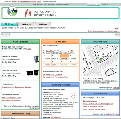
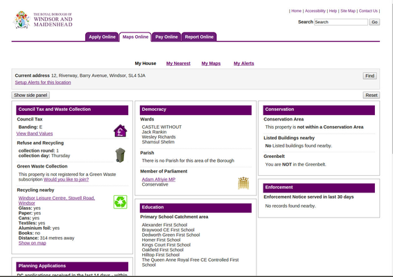
My House
The My House service is part of iShare Maps and provides information related to the entered address and its surrounding area enhanced with a small embedded map. The service is built-up from a combination of point in polygon searches (or polygon based if you have BLPU polygons), ‘back office’ system data harvested using the Data Share module, XML feeds and web services.
Using My House users would be able to:
- See the geographical extent of selected results on the embedded map or in a new full screen map (My Maps component).
- Set up a printable report about their property. This would be a rationalised export of About My Property results including a small location map.
- Collapse or expand information boxes.
The iShare administrator, via iShare Studio, would be able to:
- Choose which spatial overlays are brought through into the service
- Choose which fields from the spatial overlay are called in. These could be plain value fields or links to PDFs, web pages, images or emails.
- Set friendly names
- Set the information box title
- Set the position (order) of information boxes on the page
- Alter the number of columns displayed
The following images show different implementations of the My House component.
 |  |