/
My Nearest
My Nearest
- Kim Stimpson
Owned by Kim Stimpson
Last updated: 06 Apr, 2016
The My Nearest service is part of iShare Maps and provides information related to services, events or entities near to the entered address location further enhanced by a small embedded map. The service, which is in effect a point to point/s spatial search (or polygon based if you have BLPU polygons), provides results based from many spatial overlays such as:
- Nearest planning applications
- Nearest GP surgeries
- Parks and open spaces nearby
- Nearest recycling sites
The iShare administrator, via iShare Studio, would be able to:
- Choose which overlays are brought into the service
- Choose which fields from the spatial overlay are called in. These could be plain value fields or links to PDFs, web pages, images or emails.
- Set friendly names
- Set the information box title
- Set the position (order) of information boxes on the page
- Include a link to see a route from the entered address to the specified destination. This could utilise the vendor’s own route planning component or provide a link to Google Maps’ route planner showing the same route
- Collapse or expand information boxes
The following images show an implementation of the My Nearest component.
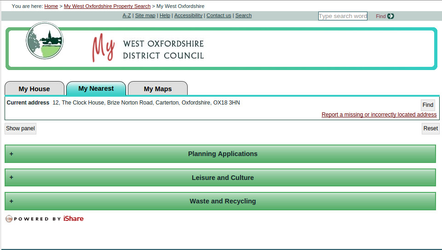 |
| Original collapsed view with Layer Groups displayed. |
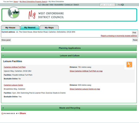 |
| Here the Leisure and Culture Layer Group has been expanded to show the individual Layer information. |
, multiple selections available,
Related content
My House
My House
More like this
Create a Find Nearest Point Layer
Create a Find Nearest Point Layer
More like this
My Nearest - How-To Articles List
My Nearest - How-To Articles List
Read with this
Configure Location Searching
Configure Location Searching
More like this
Find Address Settings
Find Address Settings
More like this
iShare Spotlight
iShare Spotlight
More like this